Overlooks & Nature Centers
Roadside attractions are some of the best hidden gems in the area. Whether you are looking to stretch your legs, have a picnic or learn about the history and geology of the area – you’ll find this list of waysides and nature centers in Cook County beneficial.
Natural & Interpretive Centers in Cook County, MN
Sugarloaf Cove Nature Center – (9096 W. Hwy 61, Schroeder, MN 55613) located on Highway 61, 73 miles northeast of Duluth and 4 miles southwest of Schroeder, is the natural place to escape the crowds and relax. The Cove is renowned for its 1.1 billion year old lava flows and its beautiful cobblestone beach.
The Center offers a breadth of nature oriented activities and learning opportunities for families and individuals:
- Guided Nature Walks and Programs
- Self-guided one mile Nature Trail
- Unique Geologic Formations
- Historic Logging Operation Artifacts
- Interpretive Center with exhibits
Chik-Wauk Museum & Nature Center – (28 Moose Pond Drive, Gunflint Trail, MN) Housed in the historic Chik-Wauk Lodge on beautiful Saganaga Lake, Chik-Wauk Museum and Nature Center presents the area’s cultural and natural history through interpretive and interactive exhibits. Learn about the Gunflint Trail’s prehistoric beginnings and people who helped shape today’s unique, rural community, including Native Americans, Voyageurs, miners, loggers, resort owners and current residents. A network of nature trails crisscross Chik-Wauk’s 50-acre grounds. Plan to immerse yourself in the Gunflint Trail forest with Chik-Wauk’s family-focused, naturalist program. To reach Chik-Wauk, follow the Gunflint Trail (Cook County Road 12) 55 miles from Grand Marais, MN to Moose Pond Drive (Cook County Road 81). Turn right and travel 1/4 mile to the entry gate for Chik-Wauk Museum & Nature Center.
Chik-Wauk Museum and Nature Center is a partnership of the Gunflint Trail Historical Society and Superior National Forest, Gunflint Ranger District.
Grand Portage National Monument – (170 Mile Creek Road, Grand Portage, MN 55605) Grand Portage National Monument is in the homeland of the Grand Portage Ojibwe. Their intimate knowledge of and connection to the land, water, plants, and wildlife of the area allowed them to endure in the sometimes harsh environment, before and after European exploration and nation-building. As other cultures explored this area, the tools and technologies of the Ojibwe were adapted by newcomers to exploit the natural resources as global commodities.
Planning a visit to Grand Portage National Monument? Get ready for:
- Eagles and woodpeckers.
- Butterflies and dragonflies.
- Forests, lakes, rivers and streams.
- A North West Company fur depot reconstructed on its exact site.
- Hiking a portion or all of the Mount Rose Trail and/or the Grand Portage corridor.
- Meeting Ojibwe people from Grand Portage Indian Reservation whose ancestors donated the historic lands to the federal government enabling the creation of the Monument in 1958.
Grand Portage National Monument Heritage Center and headquarters is open year-round and the stockade historic site is open from Memorial to Columbus weekends (mid-May to mid-October).
Wayside Rests along Minnesota’s North Shore of Lake Superior
The Minnesota state park and trail system includes four waysides along the North Shore Scenic Drive along Lake Superior in Cook County. These waysides are generally parcels of land too small to be full-fledged state parks, but with more cultural or natural resources than those found at highway waysides and rest areas. Some Minnesota state waysides are minimalist, with not much more than a parking area and a short trail. Others have sanitation facilities, picnic tables and historic buildings. These waysides have a parking limit of six hours. Overnight parking is not allowed.
Caribou Falls State Wayside Rest – (7232 Hwy 61, Silver Bay, MN 55614) Right at the Cook and Lake County boundary. There is a 3/4 mile trail within the wayside. A great hike along the Caribou River leads to the base of Caribou Falls (35 foot waterfall), and also provides stunning views of Lake Superior and the Caribou River gorge. The wayside offers access to the Superior Hiking Trail.
- Picnic area: No tables.
- Fishing: Caribou River is a designated trout stream.
- Sanitation facilities: One vault toilet.
- Established: 1947
Ray Berglund State Wayside Rest – (6355 W. Hwy 61, Tofte, MN 55615) Located near the mouth of the Onion River, the site provides a good view of Lake Superior from across U.S. Highway 61 and the Gitchi Gami State Trail. A 1/2 mile, primitive trail along the bluffs overlooks the Onion River.
- Picnic area: Picnic tables located on a nearby bluff within 100 yards, with a view of Lake Superior.
- Fishing: The Onion River is a designated trout stream.
- Sanitation facilities: There are seasonal sanitation facilities.
- Established: 1951
- Additional information: This wayside is a memorial to a St. Paul businessman and conservationist, on land donated by his friends and family.
Cut Face Creek Wayside Rest – (W. Hwy 61, Grand Marais, MN 55604) Located a few miles south of Grand Marais, this wayside rest is one of the more popular and for good reason. A lovely pebble beach with distant views of Grand Marais wait to be discovered. Soon to be connected to the Gitchi-Gami state biking trail from Grand Marais.
- Picnic area: There are picnic tables within the rest area off U.S. Highway 61.
- Sanitation facilities: There are seasonal sanitation facilities.
Kadunce River State Wayside Rest – (E. Hwy 61, Grand Marais, MN 55604) Located at the mouth of the Kadunce River, this wayside offers direct access to a Lake Superior beach. The Superior Hiking Trail spur trail continues up the river to a spectacular waterfalls and canyon.
- Picnic area: There are picnic tables within the rest area off U.S. Highway 61.
- Sanitation facilities: There are no sanitation facilities at this wayside.
- Established: 1947
Devils Track Falls State Wayside Rest – (access from the Superior Hiking Trail) Access to this wayside is via the Superior Hiking Trail either from Lindskog Road or from the Pincushion Mountain Trail System.
- Picnic area: No tables.
- Hiking: Access to Devils Track is off the Gunflint Trail via the Superior Hiking Trail.
- Sanitation facilities: There are no sanitation facilities at this wayside.
- Established: 1961
- Additional information: It is a two-mile hike, one way, to reach the wayside. From here you can visit Pincushion Mountain, a rock outcrop overlooking Lake Superior.
Wayswaugoing Bay Overlook Wayside – (E. Hwy 61, Grand Portage, MN) Just a few miles south of the US and Canada border, pull over for incredible views of Lake Superior, the Susie Islands, Mount Josephine and, on a clear day, Isle Royale. The overlook is approximately 600 feet above Lake Superior. Additional pull off areas on either side of the wayside for additional vantage points.
- Picnic Area: Tables within the rest area
- Sanitation facilities: There are seasonal sanitation facilities.
- Additional information: Viewing platform and interpretive signs
Waysides along the Gunflint Trail National Scenic Byway in Cook County
The Gunflint Trail is a 57-mile paved National Scenic Byway that winds through the heart of the Superior National Forest at the edge of the Boundary Waters Canoe Area Wilderness (BWCAW) and Canada’s Quetico National Park. The Trail and surrounding area have a rich history that includes fur trading, Ojibwa, Civilian Conservation Corps (CCC) camps, and colorful pioneers. The Gunflint Trail National Scenic Byway is famous for moose sightings and for birding. In fact, the entire Superior National Forest is designated as a Globally Important Birding Area by the American Birding Conservancy.
Pincushion Mountain Recreation Area and Overlook – (1 Pincushion Drive – 2.5 miles from Grand Marais) Pincushion Mountain provides a spectacular view of Grand Marias and its harbor and lighthouse. Picnic tables and hiking trails make this a great stop for lunch on the way up the Gunflint Trail.
George Washington Memorial Pines Ski and Hiking Area – (County Road 12 – 6.9 miles from Grand Marais) George Washington Pines Trail is a relatively short 3.3 km trail that is open to skiing and snowshoeing in winter and hiking in summer. It passes through a beautiful grove of pines, the George Washington Memorial Pine Plantation, and along Elbow Creek. The plantation was established when 13 boys from the Grand Marais Boy Scout Troop #67 planted 32 acres of land with 14,570 Norway Pine and 7,500 White Pine in 1932 after a 1927 fire.
Moose Viewing Trailhead – (County Road 12 – 22.7 miles from Grand Marais) The moose viewing wildlife observation area was developed to provide you with a viewing platform in prime moose habitat. Parking is located on the left side of the road just opposite FR 316. There is parking for approximately 15 cars. Hike down the snowmobile trail northwest for 1/4 mile to a narrow path that leads off to the right to the viewing platform. Note that you will pass a closed road on the way. Features: Wildlife viewing, 1/3 mile hiking trail, Interpretive signs along the trail, Moose terrain viewing platform (Sorry, no guarantees on moose sightings!)
Swamper Lake Wayside – (County Road 12 – 23.7 miles from Grand Marais) Stop here for a quick history lesson from the interpretive signage or for a quick bathroom break. Features: Parking, Picnic table, Latrine
Laurentian Divide Scenic Overlook – (County Road 12 – 33.3 miles from Grand Marais) The granite cliffs you’ll see while traveling the Gunflint Trail Scenic Byway are part of the Laurentian Divide. Waters on the north side of the divide flow north to Hudson Bay and the Arctic Ocean; waters on the south side flow southeast to Lake Superior, then on the Atlantic Ocean. Be sure to stop at the Laurentian Divide Scenic Overlook on Birch Lake. Features: Parking, Picnic table, Latrine, Overlook, Lake trout fishing on Birch Lake (follow path to access lake)
Gunflint Lake Overlook Wayside – (County Road 12 – 44.2 miles from Grand Marais) Take in a view of Gunflint Lake and wave to Canada.
VIEW UPCOMING NATURALIST PROGRAM EVENTS.
Special Offers
Don’t just visit Cook County. Experience it like a pro with the hottest deals in the state. We’ve worked with our local vendors, artisans and owners to curate the best prices and most unique packages for our out-of-town visitors. Check out our hot deals today.
Casino
No visit to Grand Portage is complete without a stop at the Grand Portage Lodge and Casino.
Lutsen Mountains
Dramatic, mountainous terrain and the endless beauty of Lake Superior all in one incredible place. These mountains hold endless opportunities for…
Zip Line
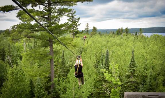
The Towering Pines Canopy Tour at Gunflint Lodge, located 43 miles up the Gunflint Trail, is one of the most fun things to do in Minnesota!
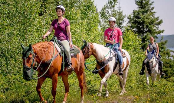
Guided Tours & Rides
We have a feeling that one important factor in your choice of visiting our fabulous destination is the many different activities and unique places to…


