Cook County sits at the far northeastern tip of Minnesota, tucked between Lake Superior, the Boundary Waters, and Canada. It feels remote because, frankly, it is.
The good news? Getting here is simple. You point yourself toward Duluth, follow Highway 61 up the North Shore, and let Lake Superior handle the scenery. The only real question is how far into Cook County you want to go.
Here is a practical guide to driving distances to Tofte, Lutsen Mountains, Grand Marais, the Gunflint Trail, and Grand Portage from a few common starting points.
Quick Distance Chart to Cook County
Approximate one-way driving distances:
| Starting Point | Tofte | Lutsen Mountains | Grand Marais | Gunflint Trail Start | End of Gunflint Trail | Grand Portage |
| Minneapolis, MN | 250 miles | 265 miles | 285 miles | 285 miles | 340 miles | 320 miles |
| Madison, WI | 480 miles | 495 miles | 515 miles | 515 miles | 570 miles | 550 miles |
| Fargo, ND | 390 miles | 405 miles | 425 miles | 425 miles | 480 miles | 460 miles |
| Eau Claire, WI | 310 miles | 325 miles | 345 miles | 345 miles | 400 miles | 380 miles |
| Des Moines, IA | 500 miles | 515 miles | 535 miles | 535 miles | 590 miles | 570 miles |
Distances are approximate and can vary depending on route, road conditions, construction, and whether your GPS gets creative.
Driving to Schroeder and Tofte
Schroeder and Tofte are the first Cook County communities you’ll reach when driving north along Highway 61. They are right on Lake Superior and make an excellent basecamp for people who want a quieter shoreline stay with easy access to trails, skiing, paddling, and scenic drives.
From Minneapolis, Schroeder and Tofte are about 250 miles, or roughly 4.5 to 5 hours depending on stops. From Eau Claire, around 310 miles. From Madison or Des Moines, you’re looking at a full-day drive, but the reward is waking up on the shore instead of next to an interstate exit. That feels like a fair trade.
This region is a smart choice if you want to explore Temperance River State Park, the Superior Hiking Trail, Sawbill Trail, or nearby inland lakes.
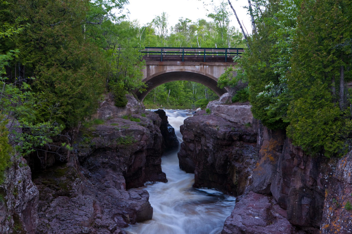
Temperance River State Park
Driving to Lutsen Mountains
Lutsen Mountains is just up the shore from Tofte and is one of the best-known landmarks in Cook County. In winter, it is the largest ski area in the Midwest. In the warmer months, it is a hub for hiking, gondola rides, mountain biking, fall colors, and Lake Superior views that make people suddenly quiet.
From Minneapolis, plan on about 265 miles. From Madison, it is close to 495 miles. From Fargo, expect roughly 405 miles.
The drive is straightforward: Duluth, then Highway 61 north. The last stretch is the good part, where cliffs, coves, state parks, and “should we pull over?” moments start showing up regularly.
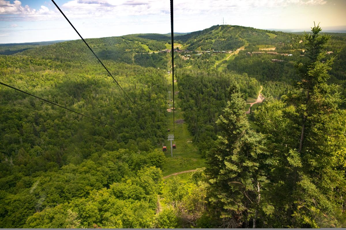
A summer gondola ride at Lutsen Mountains. Photo Credit: Wander the Map
Driving to Grand Marais
Grand Marais is the county seat and the main harbor town of Cook County. It is where you’ll find restaurants, galleries, shops, museums, North House Folk School, Grand Marais Art Colony, Artist’s Point, and the kind of small-town Lake Superior energy that makes people say, “We should stay another night.”
From Minneapolis, Grand Marais is about 285 miles, usually 5 to 5.5 hours by car. From Eau Claire, it is around 345 miles. From Madison, it is about 515 miles, and from Des Moines, about 535 miles.
Grand Marais is also where you can choose to continue northeast to Grand Portage and the Canadian Border or head inland on the Gunflint Trail. It is a natural jumping-off point for travelers heading inland toward the Boundary Waters Canoe Area Wilderness.
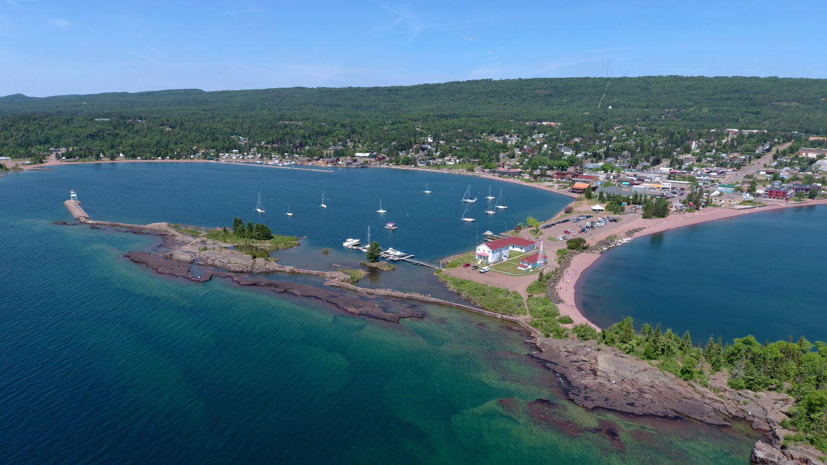
An aerial view of Grand Marais
Driving the Gunflint Trail
The Gunflint Trail starts in Grand Marais and runs about 57 miles inland to the end of the road near Saganaga Lake. It is not just a road. It is a full shift in scenery.
At the start, you leave the harbor and climb away from Lake Superior. By the end, you are deep in boreal forest, surrounded by inland lakes, lodges, outfitters, moose habitat, and Boundary Waters entry points.
From Minneapolis to the beginning of the Gunflint Trail in Grand Marais, expect about 285 miles. To reach the far end of the Gunflint Trail, plan on roughly 340 miles total. That last 57 miles takes longer than you might think, not because the road is difficult, but because it is scenic, winding, and best enjoyed without rushing.
This is the route for cabin stays, canoe trips, quiet lakes, fishing, wildlife watching, and “we have officially left the group chat” energy.
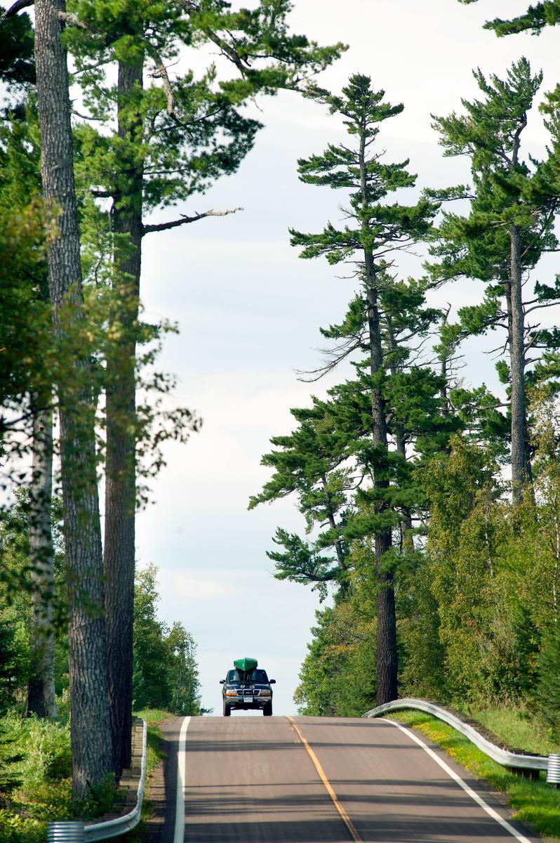
Driving the Gunflint Trail
Driving to Grand Portage
Grand Portage is the northeastern edge of Cook County and one of the most culturally and geographically significant places in Minnesota. It is home to Grand Portage National Monument, Grand Portage State Park, High Falls on the Pigeon River, and the border crossing into Canada.
From Minneapolis, Grand Portage is about 320 miles. From Madison, it is around 550 miles. From Fargo, about 460 miles. From Des Moines, close to 570 miles.
This is the farthest point on the North Shore before Canada, and it feels like it in the best way. Grand Portage is a strong choice for travelers interested in history, waterfalls, scenic drives, and quiet shoreline views away from the busiest stops.
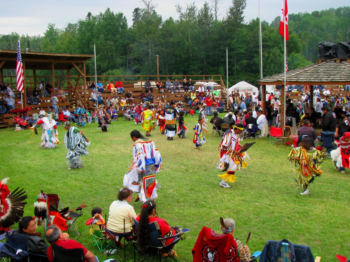
Grand Portage Rendezvous Days Celebration Pow Wow
So, How Long Should You Stay?
If you’re coming from Minneapolis or Eau Claire, a long weekend works well. You can drive up Friday, settle in, and still have two full days to explore.
From Madison, Fargo, or Des Moines, give yourself more time if you can. Cook County is absolutely doable in a long weekend, but a four or five-day trip lets you slow down and explore more than one part of the county.
The biggest mistake is assuming Cook County is one destination. It is more like several destinations stitched together by Highway 61, forest roads, shoreline towns, and trailheads.
Tofte is not Grand Marais. Grand Marais is not the Gunflint Trail. The Gunflint Trail is definitely not Grand Portage. That variety is the fun part and exploring them all is the ultimate goal.
Final Road Trip Tip
Do not measure the drive only in miles. Measure it in state parks, overlooks, coffee stops, waterfall pull-offs, and how many times someone in the car says, “Okay, this is actually really pretty.” Cook County is not around the corner. That is why it feels different when you arrive.